About pachmarhi :-
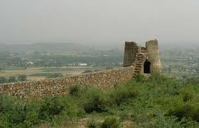
Pachmarhi is a hill station in Madhya Pradesh state of central India, also known for the Pachmarhi Cantonment. It is widely known as Satpura ki Rani ("Queen of Satpura"), situated at a height of 1100 m in a valley of the Satpura Range in Hoshangabad district. Dhupgarh, the highest point (1,350 m) in the central India region and the Vindhya and Satpura range, is located here.
History :-
Pachmarhi region was the kingdom of the Gond tribe king Bhawut Singh. Prior to annexation to the British Empire, it was the capital of this tribal dynasty. The area was introduced to the western world by Captain James Forsyth of the British Army in 1857. Pachmarhi became a hill station and sanatorium for British troops in the Central Provinces of India. The population in 1901 was 3,020, rising to double that number in the hot summer months. Pachmarhi also served as the summer capital for the Central Provinces. The forest around the town is home to many rare varieties of plants. UNESCO added Pachmarhi park to its list of Biosphere Reserves in May 2009.[2][3]
Pachmarhi got its name from Hindi word "Panch Marhi", where "Panch" means five and "Marhi" means caves. These caves were built by five Pandwa brothers of Mahabharatha epic during their fourteen years of exile. The caves are situated on a hilltop and provide an excellent vantage point.
Town :-
The town is not very large, and most of its area is under the administration of the Pachmarhi Cantonment Board, serving the Indian Army. The population of Pachmarhi is about 10,000, most of whom are connected with the Army installations in the area.
A rarely used airstrip is situated near Dhupgarh. It is overrun with grass and is seldom used. Tigers are known to have been sighted near the airstrip. Panther sightings are common along the edge of the Pachmarhi Cantonment. The indian army education corps is sited there.
Tourist Spots :-
Pachmarhi is blessed with very rich flora and fauna. It has endless nature spots, lush greenery, breadth-taking views, waterfalls, mountain streams, rich and rare wildlife. Some of the popular spots are as follows
1. Dhupgarh - Highest point of Satpura ranges. It is known for sunrise and sunset view point. At night one can see the lights of the neighboring towns such as Itarsi. At the day time the view of the lush green valley offers a captivating view. One can reach the top either by road or by trekking.
2. Chauragarh - This the second highest peak. It is a pilgrimage site with Lord Siva's temple at the top.
3. B-Hill and B-Falls - This is another hill very close to the township. On the hind side of this hill a big waterfall called B-fall. It is a popular picnic spot as it offers pristine water flowing down this fall.
4. PanarPani - Panarpani has a natural fresh water lake with forest around.
5. Sangam - This is a conflux of mountain streams behind Dhupgarh. The water in these streams is crystal clear in all seasons except of course autumn.
6. Jatashankar and Mahadeo caves - These are mountain caves with fresh water dripping from them. One can witness ecosystem at work out here with mountains feeding the streams with fresh water, the water that they soak-in during autumn. As the name suggests, these caves and many others like these are abode of lord Siva.
7. Silver Falls - Also called Rajat Prapat/Big Fall. The falls comes 2800+ feet roaring down the gorge creating a sliver streak that gives its name. The view of dense, serene, virgin forest and stream is simply mesmerizing.
8. Apsara Vihar - This is a mountain stream that creates a beautiful natural water pool, cascades and waterfall in its a course.
9. Waterfalls - Pachmarhi's ecosystem is blessed with many waterfalls. To name a few are Silver Fall, B-Fall, Little Fall, Duchess Fall etc
10. Rich Biosphere - One would love to get lost in the forests of Pachmarhi, particularly in the summer, as it is full of fruit trees such as - mangoes, jamun, custard fruit and lesser known but very delicious local fruits such khatua, tendu, chunna, khinni and chaar. The forest is also known for its richness in medicinal plants and herbs.
11. Wildlife - The jungle has tigers, panthers, beer, deer, bison, wide variety of birds etc. Tigers have retreated deeper in the forest though.
The list is endless.
Tourism :-
Pandav Caves Pachmarhi
Pachmarhi is a popular tourist retreat. Tourists visit Pachmarhi throughout the year. Pachmarhi also has a lot of cave paintings in the forests, some of which have been estimated to be as much as 10,000 years old. Shown in the picture is the garden at the base of a tourist attraction called Pandava Caves. The caves are Buddhist in origin but the name persists. The place has rich timber reserves including teak, but being a part of a reserve no new construction or felling of trees is allowed. Having a rich and rare flora as well as fauna, Pachmarhi needs central and state government approval for any new construction outside the town area.
Some of the places of tourist interest here are:
Rajat Prapat (large waterfall)
Bee Fall
Dhoot Akhilesh
Bada Mahadev
Gupt Mahadev
Chauragarh (Shiv devotees come here in huge numbers during Mahashivratri)
Dhupgarh (the highest peak of the Satpuras and Madhya Pradesh)
Handi Khoh (deep valley)
Apsara Falls (fairy pool)
Jatashankar (stalagmite-filled cave in a deep ravine)
Duchess Fall
Pachmarhi Hill (whole view of Pachmarhi City)
Pansy Pool
Waters Meet
Picadilly Circus
Patharchatta
Crumps Crag
Lady Robertson's View
Colletin Crag
Mount Rosa
Handi Kho
Reechgarh
Rajendra Giri (beautiful gardens with natural scenery)
Bansri Bihar
Little Fall
Naagdwari
Draupadi Kund
Mid Point of India
Access :-
Pachmarhi is well connected from Bhopal and Indore. Buses start from Habibganj ISBT of Bhopal and generally take close to 5–6 hours to reach Pachmarhi. The buses move through different towns like Hoshangabad, Babai, Sohagpur and Pipariya. Pipariya is the nearest railhead.
Contact Info :-
Regional Office
Tel : (07578) 252100
E-mail : pachmarhi@mptourism.com
Tourist Office (Bus Stand Pachmarhi)
Tel : (07578) 252029
Tourist Office (Railway Station, Pipariya)
Tel : (07576) 223499
Amaltas
Tel : (07578) 252098
E-mail : amaltas@mptourism.com
Champak Bungalow
Tel : (07578) 252801
E-mail : champak@mptourism.com
Glen View
Tel : (07578) 252533, 252445
E-mail : gview@mptourism.com
Hilltop Bungalow
Tel : (07578) 252846
E-mail : hilltop@mptourism.com
Hotel Highlands
Tel : (07578) 252099
E-mail : highland@mptourism.com
Panchvati
Tel : (07578) 252096
E-mail : panchvati@mptourism.com
Rock-End Manor (Heritage Hotel)
Tel : (07578) 252079
E-mail : rem@mptourism.com
Satpura Retreat
Tel : (07578) 252097
E-mail : satpura@mptourism.com
Woodland Bunglow (DIB)
Tel : (07578) 252272
E-mail : woodlands@mptourism.com
Pachmarhi short detail :-
पचमढ़ी
— hill station —
Coordinates:- 22.4667°N 78.4333°ECoordinates: 22.4667°N 78.4333°E
Country- India
State- Madhya Pradesh
District- Hoshangabad
Elevation- 1,100 m (3,600 ft)
Time zone- IST (UTC+5:30)
PIN- 461881
Telephone code- 917578
Vehicle registration MP-05
Nearest city- Pipariya
SADA Pachmarhi :-
Pachmarhi is 54 km from Pipariya Railway station. 150 km from Itarsi Railway station. Nearest Airport is Bhopal 210 Km, Indore 390 km, Jabalpur 250 Km and Nagpur 270 Km. Pachmarhi is located at 3500 feet above sea level near the heart of Madhya Pradesh the “Queen of the Hills” Satpura Range. Pachmarhi is located adjoining Satpura Tiger Reserve which is a national park. Special Area Development Authority (SADA) is an autonomous body of Madhya Pradesh Government. Apart from providing municipal facilities to the civil area of Pachmarhi (Civil Area is separate from Cantonment area i.e.; market vicinity). We maintain several parks/gardens/boat club and provide hotel facilities to the tourists. We offer lodging and boarding to the tourists amongst sprawling greenery away from the noise and congested narrow streets of the market at such reasonable prices, you will be surprised. You will also feel secure and at home with us.
hotels click here :-
hotels pachmarhi
Getting there:-
Nearest airport is at Bhopal (195 km) connected by regular flights with Delhi, Gwalior, Jabalpur, Indore and Mumbai.
Pachmarhi is connected by regular bus services with Bhopal, Hoshangabad, Nagpur, Pipariya and Chhindwara. Taxis are available at Pipariya.
Pipariya (47 km), on the Mumbai-Howrah mainline via Allahabad, is the most convenient railhead.
MUST SEE PLACES :-
PRIYADARSHINI (FORSYTH POINT):
This vantage viewing point marks the place from where Pachmarhi was discovered by Captain Forsyth in 1857. The British developed Pachmarhi as a resort and their influence is embodied in its churches and colonial architecture.
JAMUNA PRAPAT (BEE FALL):
A spectacular fall in the stream which provides drinking water to Pachmarhi. The bathing pools above the fall are very popular. Handi Khoh: Pachmarhi's most impressive ravine has a 300 feet high precipice and dramatically steep sides.
APSARA VIHAR (FAIRY POOL):
Easily accessible from Jai Stambh, this 'fairy pool' is an ideal picnic spot for families with small children, since the pool is shallow, deepening only towards the base of the fall.
RAJAT PRAPAT (BIG FALL):
Those seeking adventure will find it in this ten-minute walk over rocks and boulders from Apsara Vihar to the top of Rajat Prapat, the 'big fall'.
IRENE POOL
This pool was discovered by Irene Bose, wife of Justice Vivian Bose, and named after her. The route upstream leads to a cave, through which the stream goes underground and then over a khud in a series of falls.
JALAWATARAN (DUCHESS FALLS):
The descent is steep and the trek strenuous for almost all of the 4 km to the base of the fall's first cascade.
SUNDER KUND (SAUNDER'S POOL):
Crossing the stream below Duchess Fall and following a footpath about 2.5 km in a south- west direction, brings one to a huge rocky pool that is excellent for a refreshing swim.
MAHADEO:
Regarded as holy for countless of generations, Mahadeo hill has a shrine with an idol of Lord Shiva and an impressive Shivlinga. On the East side of the hill is an excellent cave shelter with beautiful cave paintings.
CHHOTA MAHADEO:
Revered as a sacred spot, this is a narrow point in the valley with rocks overhanging a stream and a spring from where water cascades down.
CHAURAGARH:
4 kms from Mahadeo, it is one of Satpura's prominent land marks, the summit crowned with emblems of Mahadeo worship.
JATA SHANKAR:
A sacred cave under a mass of loose boulders in which the Jambu Dwip stream has its source. A rocky formation of this place resembles the matted locks of Lord Shiva, hence the name.
DHOOPGARH:
The highest point in the Satpura range, with a magnificent view of the surrounding ranges. A very popular spot for viewing sunsets.
PANDAV CAVES:
Five ancient dwellings excavated in the sandstone rock in a low hill. Pachmarhi derives its name from these caves which, as the legend goes, once provided sanctuary to the five Pandav brothers. These caves are now protected monuments.
TRIDHARA (PICCADILY CIRCUS):
A popular picnic spot where two streams meet in a junction.
VANSHREE VIHAR (PANSY POOL):
A beautiful spot on the Denwa stream, cool and shady among trees, ferns and semi-tropical vegetation.
REECHHGARH:
A wonderful natural amphitheater in the rock, approached through a cave-like entrance on the South-side.
SANGAM (FULLER'S KHUD - WATERS MEET):
This is the lowest of the picnic spots on the Denwa and offers fairly good bathing pools both below and above the meeting of the waters.
CATHOLIC CHURCH:
Built in 1892 by the British, the Catholic Church is a blend of the French and Irish architecture. Its Belgium stained-glass windows add rare attraction and beauty to the building. The church has a cemetery attached to it and graves date from 1859, World War I & II.
CHRIST CHURCH:
Built in 1875 by the British, this Church's architecture is fascinating; its 'sanctum- sanctorum' has a hemispherical dome on top with its ribs ending with faces of angels. The stained glass panes adorning the walls and rear of the altar were imported from Europe. They present a gorgeous view as the sun rays pass through them. The nave of the church does not contain even a single pillar for support. The baptismal font is a rare brass piece and the bell is as old as the church and its chimes can be heard from a long distance.
SATPURA NATIONAL PARK:
Set up in 1981, Satpura National Park is 524 sq km in area. It spreads through dense forest of evergreen sal, teak and bamboo. The high peaks of Dhoopgarh and Mahadeo, Bori's legendary teak and bamboo forests, Pachmarhi's fascinating natural beauty of deep valleys, high mountains, rivulets, waterfalls and Tawa's vast reservoir combine to give this park unique beauty and a breathtaking variety of attractions. The park is home to the bison, tiger, Leopard, bear, four-horned deer, blue-bull and a rich variety of birds.
BISON LODGE:
Constructed in 1862, the Bison Lodge is the oldest house in Pachmarhi. It now houses a beautiful museum depicting the rich flora and fauna of Pachmarhi.
THE CAVE SHELTERS:-
Some of the best cave shelters and groups of shelters around Pachmarhi are: Dhuandhar, approached from the footpath to Apsara Vihar, the paintings mostly in white include a group of archers with the typical Gond bun and hooped earrings. Bharat Neer (Dorothy Deep), has well executed animal paintings and when excavated in the 1930s yielded many pottery shards and microliths. Asthachal (Monte Rosa), there are four shelters with paintings, comparatively early linear drawings. Along the northern side of Jambu Dwip valley are some six shelters with many paintings of animals and human figures, including a detailed battle scene. Harper's Cave, so named because of one of its paintings - a man seated and playing a harp is close to the Jata Shankar Shrine. The Chieftain's Cave derives its name from a battle scene showing two chieftains on horses. A terrace that runs the length of the South, South East and East faces of Kites Crag has some fine cave paintings, the majority of which are in white or outlined in red.

.jpg)

.jpg)


.jpg)


.jpg)


.jpg)
.jpg)


